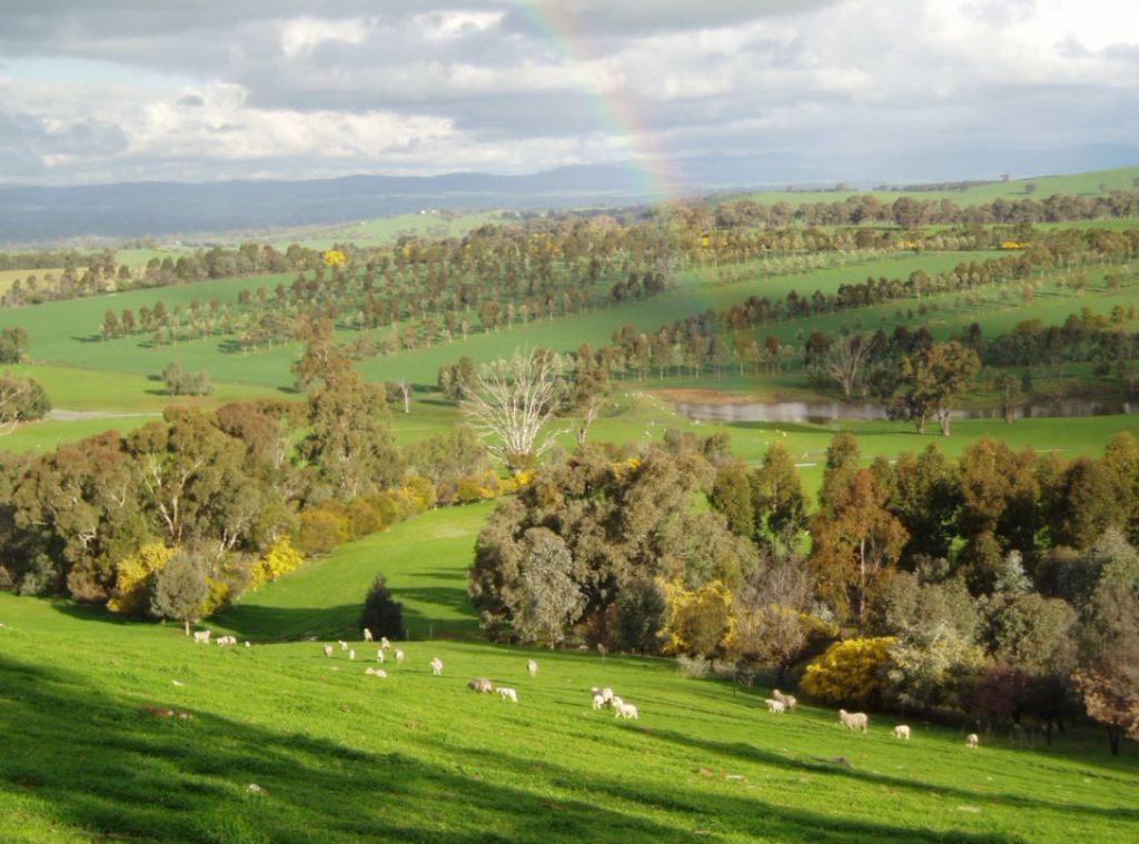
The Holbrook Landcare Network Self-drive Ecotour is a showcase of the work that landholders have done to address issues such as salinity, erosion, declining water quality and loss of biodiversity in the landscape. It is a way to see and experience the environmental benefits of Landcare and the highlights of the Holbrook region.
The Holbrook community have a strong commitment to the environment, demonstrated through participation in many programs and projects undertaken since 1989, including revegetation, farm forestry, soil conservation works and looking after remnant bush. Farmers contribute significant time, money, and resources to make these projects happen but are also often able to access grants to help with covering some costs. Throughout the region, landholders have worked in partnership with Federal, State and Local Government and philanthropic organisations to change the landscape with millions of trees planted and many kilometres of fencing to protect them from stock grazing.
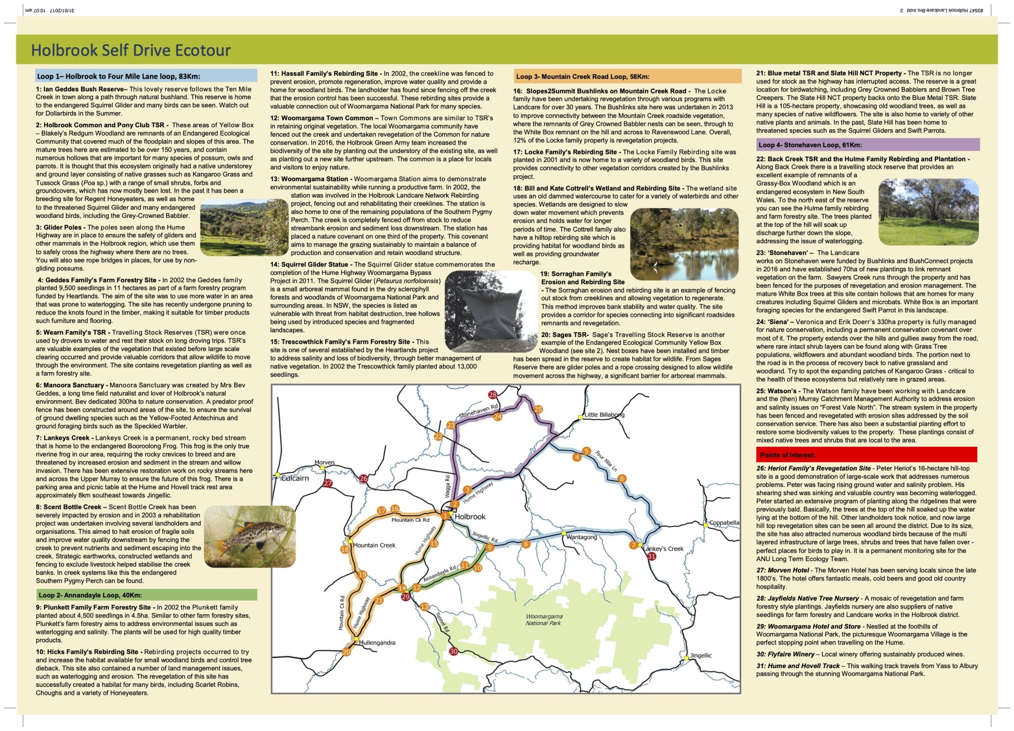
How the Tour Works
The tour comprises of four loops. Each site is sign posted with a coloured disk and a number. This brochure will provide you with a map of each loop, as well as details about each site. Quick response codes (QR codes) are provided below and will link to our website that provides further information on the sites and their significance.

Rest Areas and Parking
The tour is intended to be drive-by, and no permission is given to enter private property. Some of the sites located on the tour are not safe for stopping while others, such as the Squirrel Glider statue are safe to pull into and have parking areas suitable for caravans. There are toilet facilities located in Holbrook (Submarine Rest area and 10 Mile Creek Gardens), Woomargama Village and along the Hume Highway at Blue Metal & Little Billabong Rest Areas.
Significant Roadside Environment
As you’re driving around the Holbrook region keep an eye out for the ‘significant roadside environment’ signs. Significant roadside reserves are protected due to their invaluable habitat and corridors. These reserves often link with other vegetation remnants in the landscape and provide connectivity. Roadside reserves are often home to small patches of remnant vegetation, which are important within our landscape. These roadsides are marked with a sign to ensure that any roadside works do not harm the existing habitat.
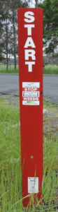
Roadside Red Guide posts
Red guide posts are being installed throughout the region to identify areas of high risk noxious weeds. The sites are flagged by a ‘start’ and ‘end’ red guide post along the site of the roads that show the beginning and the end of an infestation. By avoiding vehicles and machinery stopping in these areas between the red guide posts, we can stop the spread of noxious weeds throughout our region.
Significant Projects on the Ecotour
Rebirding (2000–2003)
In 2000 Holbrook Landcare started the Rebirding project, funded by the Australian Government, aimed at addressing the issue of tree dieback within the region. Forty percent of trees in the landscape were being eaten alive by large numbers of sap sucking insects. To combat this issue, revegetation including shrubby understory was planted to provide a sanctuary for insect eating birds. The project has been successful in established 2000 hectares of vegetation and bringing birdlife back into the region.
Heartlands: towards sustainable land use in the Murray Darling Basin (2001—2004)
Heartlands was a collaboration between the CSIRO, Murray Darling Basin Commission, State and Commonwealth Governments, local people and Landcare Groups in the Billabong Creek catchment. The project aimed at improving our farming systems to be economically viable as well as being environmentally sustainable. Environmental issues such as waterlogging and salinity are also addressed at these sites through revegetation, farm forestry and perennial pastures.
Slopes to Summit (S2S) Bushlinks (2012-2016)
This large scale revegetation project funded
by the Australian Government established 1200ha of vegetation in the region. S2S is an established connectivity conservation partnership that is part of the Great Eastern Ranges (GER) Initiative, based in the NSW South West Slopes. S2S Bushlinks has focused on strengthening landscape connectivity throughout the Holbrook region. Through the S2S Bushlinks project, over 1200 hectares of revegetation has occurred since 2012.
The Ecotour Map
Work Health and Safety Warning
Please always drive safely and take note that this is a drive by tour only. Do not venture onto farms without landholder permission as this may interfere with livestock and farming operations and may result in possible injury to yourself. Holbrook Landcare Network has made every attempt to ensure the accuracy of all ecotour details and accept no responsibility or liability for any omission or inaccurate information.